
Balasore District, an administrative district of Orissa, is considered as the Granary of Orissa. Balasore is the launch station for sounding rockets in Orissa state. The rocket-launching centre is situated at a place called Chandipur. It was at Balasore that tests for various missiles such as Agni, Prithvi Trishul, etc. were carried out. Balasore is a city in the north of Orissa. Balasore covers a total area of 3076 sq kms. Balasore District is one of the most important districts of Orissa which finds place in the National map for its history, geographical situation, culture, marine development and for various important institutions.
Location of Balasore District
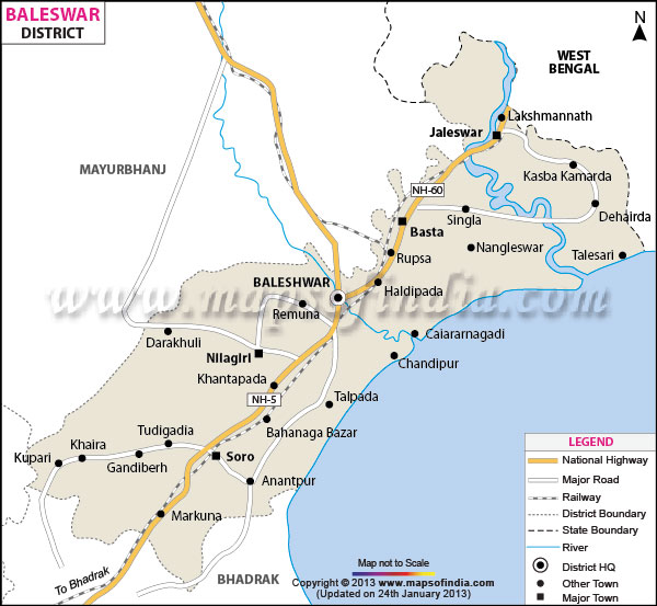
Location of Balasore District
Balasore District is one of the coastal districts of Orissa lying on the northern most part of the state having 21 degree 3 minutes to 21 degree 59 minutes north latitude and 86 degree 20 minutes to 87 degree 29 minutes east longitude. It is bounded by Midnapore district of West Bengal in its north, by the Bay of Bengal on the east and Bhadrak district lies on its south whereas it is surrounded by Mayurbhanj District and Kendujhar district on its western side.
History of Balasore District
Balasore District was part of the ancient Kalinga which later became a territory of Toshala or Utkal, till the death of Mukunda Dev. It was annexed by Mughals in 1568 and remained as a part of their sovereignty up to the middle of 18th century. Then the Mahrattas occupied this part of Orissa and it became a part of the dominion of the Mahratta Rajas of Nagpur. The East India Company ceded this part through a treaty called treaty of Deogaon in 1803 and it became a part of Bengal Presidency up to 1912. But the first English Settlement came into existence in Balasore region in 1634 while Shah Jahan was the emperor of Delhi. The state of Nilagiri merged with state of Orissa in January, 1948 and became a part of Balasore district. On 3rd of April, 1993 Bhadrak Sub-division became a separate district. Historical legend ascribes that the district has been named as per Lord Baneshwar, which subsequently changed to Balasore during Mughal Rules.
Geography of Balasore District
Broadly Balasore District can be divided into three geographical regions, namely, the Coastal belt, the inner alluvial plain and the North-Western hills. The coastal belt is about 26 kilometres wide and shapes like a strip. In this region, sand dunes are noticed along the coast with some ridges. This region is mostly flooded with brackish water of estuarine rivers which is unsuitable for cultivation. The second adjacent geographical region is deltaic alluvial plain. It is a wide stretch of highly fertile and irrigated land. This area is highly populous and devoid of any forests. The third region is mostly hilly terrain and vegetated with tropical semi-ever green forest. Balasore, the coastal district of Orissa is crisscrossed with perennial and estuarine rivers because of its proximity to sea. The irrigation system in Balasore district is quite extensive. Industrialization is also gaining ground around Balasore town. The soil of Balasore district is mostly alluvial laterite. The soil of Central region is mostly clay, clay loam and sandy loam which is very fertile for paddy and other farm produces. Moreover, a small strip of saline soil is also seen along the extreme coastal part of the district.
The climate of Balasore District is mostly hot and humid. The hot season starts from March till May and followed by rainy season from June to September. During this period, south-west monsoon causes maximum rain. But the district experiences highest rain fall during July and August. Because of its strategic location, this district faces most of the cyclonic storm and depression which is raised from Bay of Bengal. The cold season from December to February is very pleasant. The average temperature of the district varies between 22 degree Celsius to 32 degree Celsius and the average rain fall is 1583 mm.
Demography of Balasore District
As per the 2001 Census, total population of Balasore District is 20,23,000 comprising 10,38,000 males and 9,85,000 females. The average literacy rate of the city is 76 percent, higher than the national average of 59.5 percent. Male literacy rate of the district is 56 percent and female literacy rate is 44 percent.
Administration of Balasore District
The two sub divisions of Balasore District are Balasore and Nilagiri having 19 Police Stations, seven Tehsils for revenue and administrative purposes. Only Nilagiri sub division is of hilly region with hillocks and forests. For undertaking developmental works in the rural areas, the district is also divided into 12 Development Blocks namely Bhograi, Jaleswar, Baliapal, Basta, Balasore, Remuna, Nilagiri, Oupada, Khaira, Soro and Bahanaga. Besides, there are four statutory towns consisting of one municipality under the administration of Balasore District. These local bodies look into civic aspects of urban areas.
Tourism in Balasore District
Balasore District is a place of scenic beauty and is one of the major tourist attractions of the state. The stretches of green lands, network of rivers, blue hills and extensive meadows adds to the natural beauty of the place. The place is a major tourist attraction because of the presence of many temples in this area. Some of the main places of attraction in Balasore District are Remuna, Chandaneswar, Panchalingeswar, Sajanagar, Ayodya, Maninageswar Temple at Bardhanpur and many more.
The South Eastern Railway covers a distance of around 102 kms within Balasore District connecting it with Kolkata, Bhubaneswar and Chennai. Moreover, National highways 5 and 60 pass through the district and runs from Kolkata to Chennai.


1 comments:
I just came to your post and reading above thing it is very impressive me and it is very nice blog. Thanks a lot for sharing this.
Tourist Places in Balasore
Post a Comment