Friday 28 October 2011

Nabarangpur district


Nabarangpur, the south west district of Orissa, is situated in the midst of nature. This enchanting district has a unique culture and history. The people living here are also quite interesting. Home to more than ten tribes, and with more than half the population being tribal, Nabarangpur district has a vibrant life style.

Location of Nabarangpur district

Nabarangpur district is located in the district of Orissa. The district headquarters is in the city of Nabarangpur. Situated in the south west corners of Orissa, Nabarangpur district`s boundary stretches in the north to Kalahandi district, west to Jagdalpur district, east to Kalahandi and Rayagada district and south to Koraput District. The Indravati River forms the border between Nabarangpur and Koraput districts. It lies at 19.14` latitude and 82.32` longitude at an average elevation of 1,876 feet (572 m).

History of Nabarangpur district

History of Nabarangpur is inextricably interlinked with that of Koraput District ruled by the Solar Dynasty of Jeypore. It was ruled by the rulers of solar dynasty. The language, life style, heritage, geographical location, flora and fauna and even climate of Nabarangpur are not dissimilar from the rest of the component of Koraput district. The Atavika people were native of Koraput, and valiantly fought the Kalinga war in the 3rd century BC. The Satavahans, the Ikshvakus, and the Nalas ruled subsequently ruled over the Nabarangpur district. During the 14th century the region came under the authority of the British Empire. The district of Nabarangpur came into being much later on 2nd October 1992.

Geography of Nabarangpur district

Nabarangpur district experiences the first arrival of monsoon where as the rest of the state take about ten days more for the same ecstasy. While the rest of Orissa gets rain due to monsoon from the Bay of Bengal, the whole of Nabarangpur derives it straight from the Arabian Sea through the Southwest direction. Nabarangpur enjoys adequate rainfall and there is hardly any dry spell, acute shortage of food, or drought.

People of Nabarangpur

There are several tribes dwelling in the district of Nabarangpur. Nomadic and aboriginal inhabitants also live here. Encounter with the settled and urban population has changed the lifestyle of the tribal people but few choose to continue with their primitive way of living. The main language spoken here is Oriya. Hindus, Muslims and Christianity are the three major religion practiced in this district of Orissa.

Culture of Nabarangpur

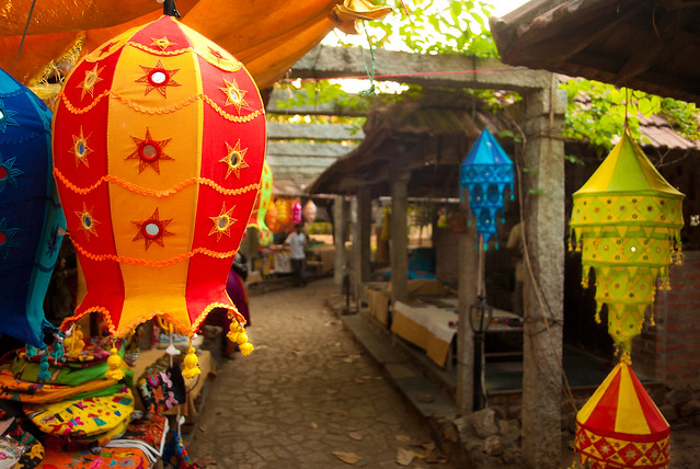
Culture of Nabarangpur is quite fascinating. The main Hindu festivals celebrated here are Ratha Yatra, Maha shiva ratri, holi and Dusshera. Both the town dwellers and and tribal people come together to mark these occasions. Holi, the riotous festival of spring is a three day long celebration. The Ratha Yatra is the biggest festival celebrated here. The presiding deity is Lord Jagannath. Dussehra is again a ten-day long Hindu festival, a time in which Goddess Durga, epitome of power and energy, motherhood of the whole universe, is worshipped with due fervour and solemnity. The Muharam of the Muslims is a day of prayer and remembrance. The Christmas Day marks the beginning of a long festival running up to the New Year`s Day. Christians of all hues celebrate at home, churches and open fields.

Tourism in Nabarangpur district

Tourism in Nabarangpur is undoubtedly a fascinating experience. The ancient temples are noteworthy of their mythological importance and architectural splendour. Maa Pendrani temple, Maa Bhandargharani temple and Lord Jagannath temple are much visited places of this district. Pilgrim tourists come here to offer their prayers and get blessings. The temples are also noted for their architectural wonder. The dams of this district serve as great picnic spots for the visitors. The Sahid Minar and the Sahid Smriti Stambha are the two famous historical monuments of Nabarangpur district. The Deer Park here also attracts a large crowd. Watching Nature`s bounties from the watch Tower in this park is a unique experience. Gosein Dorah and Chandan Dhara are the natural waterfalls which are huge crowd pullers. When it comes to tourism, this south western state of Orissa has a lot to offer.

Koraput District


Koraput District, an administrative district of Orissa, was created on 1st.April, 1936. It has its headquarters at Koraput. In the backdrop of green valleys contemplating immaculate freshness, Koraput District is the hub of the tribal population in Orissa. Bounty of meadows, forests, waterfalls, terraced valleys and darting springs dotted over the district makes it alluring to the nature loving people. Only with a small geographical area of about 8379 sq kms, Koraput district is one of the historical districts of the state of Orissa.

Location of Koraput District

Koraput District is located between 17 degree 40 minutes 20 degree 7 minutes north latitude and between 81 degree 24 minutes 84 degrees 2 minutes east longitude. Average altitude of the district is 2900 feet above the sea level. Total geographical area of the district is 8379 sq kms. Koraput District is bounded by Rayagada District and Srikakulam District of Andhra Pradesh in the east. It is surrounded by Bastar District of Chhattisgarh in the west, by Nowarangpur District, Vizianagaram District and Visakhapatnam District of Andhra Pradesh in the south.

History of Koraput District

Regarding the historical facts of Koraput, not much is known. Since, the past records of the Koraput district are limited to the excavated facts and the mere assumptions of the historians, a codified historical document of the Koraput district does not exist. As far as the history of Koraput is concerned, the region of Koraput existed far back in the 3rd century BC when it belonged to the valiant and dreaded Atavika people. The vigorous Atavika, the original inhabitants of the Koraput fought hard to retain their kingdom and glory but unfortunately subdued by the Mauryas in the Kalinga warfare. As the chronicle of Koraput runs, Koraput was under the Mauryas for a consid erable period of time. The region successively came to be ruled by several dynasties, like Satavahans, Ikshvakus, Nalas, Ganga kings and kings of Suryavanshi, who dominated the Koraput region before the arrival of the British. It was the British, who composed the separate district of Koraput in the year of 1936 and in the post independence period it was adjoined with the Orissa province of Indian Union. Koraput abounds in the imprints of Orissa`s glorious past.

Culture of Koraput District

Handicrafts of Koraput District reflect the vivid imagination and skillful creativity of the indigenous people. The exquisite, vegetable-dyed scarves and saris spun by `Mirgan` weavers are Koraput`s signature handicrafts, nationally awarded and internationally renowned for their breathtaking beauty and rare artistry. Besides these, there are other handicrafts ranging from terracotta to metal work. Likewise Koraput Region is also rich with traditional art, craft, like paper making, mask making, lacquer art, bamboo crafts, docra casting, terracotta, metal works, weaving, leaf art, paddy craft etc. Every aspect of tribal life is charming and colourful. But the place of honour is occupied by tribal dance and music. The invigorating dances set to the beat of tapping music of traditional instruments are a way of life for the tribal communities. In all seasons and occasions, the people sing and dance in Koraput.

Tourism in Koraput District

Koraput District offers several sightseeing options. Koraput has several places of the interest that attract people from far and wide. There is a Tribal Museum in the district headquarters caters to and educates the tourists about the culture and heritage of the tribal communities. The majestic waterfall, also known as `Matsya Tirtha` falls from a height of 175 meters. A hydroelectric project with its winch developed amidst deep greenery is a place for pleasure. Important cave shrine of Lord Shiva situated on a lime stone hill on the bank of Kolab River, surrounded by natural scenery.

Temples, monasteries and other historical monuments from the medieval period with great historical significance stand as footprints to tell the story of the rich history of Koraput District.

Jharsuguda District


Jharsuguda District, an administrative district of Orissa, was formed in the year 1994. With a total area of 2,081 sq kms and an average population of 514853, Jharsuguda District is rich in economically important mineral, especially coal. Jharsuguda Town is the headquarters of the newly formed district. However, the consolidated region of Jharsuguda has a rich history, which dates back far to the epoch of the Chauhan kings.

History of Jharsuguda District

During the British rule, Jharsuguda formed a part of Sambalpur District. The new district of Jharsuguda came into existence on 1st of April, 1994 and was created by amalgamation of the erstwhile Zamindars of Rampur, Kolabira, Padampur and Kudabaga. It is revealed from history of Sambalpur District that Jharsuguda was known as "Jharguda" in the distant past. As per folklores a tribal group from Jharkhand established Jharsuguda during 12th Century AD. Siva Singh, a descendant of Sambalpur royal family ruled as Jagirdar of the area comprising 12 villages namely Jharsuguda, Badheimunda, Debadihi, Kumdapali, Kureibaga, Banjari, Dalki, Balijori, Beheramal, Ekatali, Buromal, and Sarbahal. After this period the decline of Sambalpur state started due to aggression and occupation of Sambalpur by the Mahrattas Bhonsle. In the year 1951, as per the Orissa Government Notification, Jharsuguda Union Board was replaced by Jharsuguda Municipality with 13 wards. Jharsuguda remained under the Sadar sub division of Sambalpur till 1979. As per the state government notification Jharsuguda was declared as Sub-Division in 1979. The Sub-Division with its five component blocks namely Jharsuguda, Kolabira, Laikera, Kirmira and Lakhanpur became a district in the year 1994.

Culture of Jharsuguda District

Jharsuguda District has a rich and developed cultural heritage. Various fairs and festivals observed round the year for centuries, indicates its cultural and religious richness. Though many of the fairs and festivals are common to other parts of Orissa there are few which are distinct and special. Some of the indigenous festivals of Jharsuguda District are Ranjta Festival, Ratha Yatra of Kukurjunga, Gokulastami Jatra of Rajpur and Makar Ratha Jatra of Belpahar.

Tourism in Jharsuguda District

Jharsuguda District is one of the popular tourist destinations of Orissa. This district offers several places of interest for exploring. Rock Painting and Lithography of Bikramkhol, Ruins of Hill Forts of Ulapgarh, Padmasini Temple of Padampur, Ramchandi, Koilighughar Waterfall, Ancient Siva Shrine of Jhadeswar Temple, Shree Pahadeswar Temple, Shiva Shrine of Mahadebpali and Historical Kolabira Fort are some of the prominent attractions of Jharsuguda District.

Of all the districts of Orissa, Jharsuguda District is considered to be the richest in mines, industries and business.

Dhenkanal District


Dhenkanal District is an administrative district of Orissa. This district, situated on the Cuttack-Sambalpur road is believed to have derived its name from a Savara chief named Dhenka, who have ruled the land. The significance of Dhenkanal District lies in the profound historical evidences and interest with which Dhenkanal is endowed. This district of Orissa is popular as a famous religious site for a period of over hundred years. The antiquity of Dhenkanal District is evident from the historical details of the district. Dhenkanal District is bounded by the Keonjhar District in north, Cuttack District in south, Jajpur District in the east and Angul District in the west. This district lies between longitudes 85 degree 58 minutes to 86 degree 2 minutes east and latitude 20 degree 29 minutes to 21 degree 11 minutes north.

History of Dhenkanal District

As the archaeological evidences depict that the region of present Dhenkanal was inhabited since the prehistoric times when there was no organized administrative authority. However the historical facts of Dhenkanal during the prehistoric times are in dark oblivion, due to the nonexistence of any written documents. Thus, the prehistoric facts of Dhenkanal are solely dependent on the archaeological evidences and the rock inscription. The Nasik rock inscription reveals that during 2nd century A.D, the tract of Dhenkanal was under the Sattavahana dynasty, while in the 3rd and 4th centuries A.D, the Guptas were at the helm of the administration. In the 6th and 7th century A.D, Dhenkanal came in the hands of the Bhauma karas. Finally the Sulki dynasty grabbed Dhenkanal from the Bhauma Karas and continued to be the absolute authority of Dhenkanal till 9th century. As the history of Dhenkanal contemplates, the authority of Dhenkanal has been passed under various kings and chiefs belonging to various dynasties.

During the Somavansi expedition, the vast tract of Dhenkanal was occupied by them who continued to be the sovereign authority of the Dhenkanal for couple of years. But if the history of Dhenkanal is to be followed, the district of Dhenkanal made an active progress during the Gangas, who ousted the Somavansis from their former state. The Gangas, in addition of being sophisticated than the erstwhile kings were the warrior tribes. The unremitting desires of the Ganga kings to be the master of the maximum part of Orissa laid the foundation of their downfall. The incompetent successor of the Ganga rulers could not retain the status of integrated whole of the kingdom and in the later part of their rule, Dhenkanal, including the other parts of Orissa were fragmented into several sections.

Further, historical accounts of Dhenkanal specify that when the Suryavanshis ascended the throne of Dhenkanal, the entire region was disintegrated completely. Hence, the historical documents of disintegrated Dhenkanal during the reign of the Suryavanshis are likely to be non-existent. However, the most accepted view is that the authentic historical details of Dhenkanal are codified right from the time when a tribal chief mainly Dhenka, ruled Ghumuranali, Dudianali and Kantanali encompassing a significant portion of present Dhenkanal. He was a Savara and was a ferocious warrior. He named his kingdom `Dhenkanal` after his name, as the popular faith runs. But the Savara chief was not destined to be the sovereign authority of Dhenkanal for long. Finally Sridhar Bhanja of Besalia defeated and killed the chief in the battle. Moreover, the history of Dhenkanal District was concluded with the Bhanja rulers as the supreme authority of the whole of Orissa till the independence of India. Finally the princely state of Dhenkanal was merged with the Indian Union, after the country`s independence in 1947.

Dhenkanal District contains a centre of religions movement called `Mahima Dharma` since last 100 years or more and spread over through out the Indian Union. The religious movement in the medieval period also touched to this district. The famous `Kapilash Hill`, which is popularly known as the `Kailash` of Utkal, lies in this district. Lord Chandrasekhar Mahadev temple is set up at the top of the hill.

Geography of Dhenkanal District

Major portion of Dhenkanal District is covered with dense forest and a long range of hills. Hence, this district is called as the `Home of elephants and tigers for the country`. The climate of the Dhenkanal District is hot and dry, sub humid type with an average annual rainfall of 1696 mm. The average minimum and maximum temperatures are around 19 degree Celsius and 33 degree Celsius respectively. The humidity is generally high varying from 31 percent to 88 percent. The climate is hot during April and May and cold during December and January. The monsoon generally breaks during the month of June.

Economy of Dhenkanal District

Economy of Dhenkanal District is mainly agrarian in character. An agricultural district like Dhenkanal gains much from forests which plays an important role in the economy of the district. The principal forest products are Timber, Bamboo, Fire wood and Kendu leaf. The minor forest products are Lac, Honey, Kenduli Gum, Wax, Mahua flower, Sunari fark, Siali Leaves, Catechus, Tassar Cocoons and other raw materials used for medicine. Some large scale industries like Nilachal Refractories, Utkal Asbestos Ltd, Orissa Polyfibres Ltd, Shakti sugar are also established in this district.

Dhenkanal District has proper educational, healthcare and banking system. Moreover, the tourist places of this region attract the travellers from different parts of the world. Culture of Dhenkanal District is mixed and diverse in nature.

Cuttack District


Cuttack District is one of the most important districts in the state of Orissa with its administrative headquarters located at Cuttack city. Legend suggests that the name Cuttack has been derived from the Sanskrit word `Kataka`, which means a military camp or a fort or a government seat, protected by an army. It is one of the oldest cities in India and the business capital of Orissa. Nestled at the land formed by the Mahanadi River in the north and Kathajodi in the south, Cuttack is a picturesque district. The entire district of Cuttack is well connected by railways and the nearest airport is the Biju Patnaik Airport. Cuttack has been enjoying all along the unique privilege of being the administrative and commercial nerve centre of Orissa .It was the seat of the commissioner of Orissa Division till 1936 and with the formation of the province of Orissa in that year it was exalted to be the headquarter of the new province.

History of Cuttack District

The history of Cuttack District is associated with the Keshari dynasty. In the remote past Cuttack was connected both by land routes and waterways with the renowned medieval ports like Chelitalo, Palur and Tarmalipti. Although politically Cuttack was not that significant before eight century A.D, but it was a flourishing mart of Eastern trade. However, Cuttack became a capital city as the end of the 10th century A.D during the reign of Somvanshi dynasty of Orissa. History states that the reign of Markata Keshari was distinguished for the construction of the stone embankment to protect the new capital from flood in 1002 A.D. The city of Cuttack started as a military cantonment because of its secure situation that further developed into the capital of the state of Orissa. In 1211, Cuttack became the capital of Anangabhimadeva of the Ganga dynasty. The reference from Ain-i-Akbari clearly denotes that Cuttack was a flourishing capital city during the time of Mukunda Deva. On the eve of Afghan occupation, Cuttack was found as a well guarded and heavily equipped capital.

The importance of Cuttack rapidly increased after the occupation of Orissa by Chohagangadeva early in the 12th century A.D. With the end of the Ganga rule Orissa passed into the hands of the Barabati Fort. By 1750 Cuttack came under the Marathas as it was a vital point of contact between the Marathas of Nagpur and the English merchants of Bengal. During the rule of Marathas, Cuttack greatly prospered as an emporium of trade and commerce. As per the treaty of Deogaon, Cuttack came under British occupation in 1803 and the English set themselves to the task of consolidation and land revenue administration. The British occupied it in 1803 and later it became the capital of Orissa in 1816. After independence in 1948 Bhubaneshwar was made the capital of Orissa although Cuttack continued to remain its administrative head.

Geography of Cuttack District

Cuttack District is located between 84 degree 58 minutes to 86 degree 20 minutes east longitude and 20 degree 3 minutes to 20 degree 40 minutes north latitude. Covering an area of about 5915 sq km. Cuttack District is located at an altitude of about 15 metres and receives an annual rainfall of about 1443.9 mm. Its climate is hot and humid. During the summer the mercury rises as high as 40 degree Celsius while during the winters temperature falls as low as 10 degree Celsius. Summer starts at the end of March and lasts till June till the monsoons sets in. During the monsoons the city receives an average rainfall of 144.39 cm during September to mid October. Winter season starts from November and lasts till January and is characterised by chill winds from the north. Mid January to mid March is pleasant with moderate climate.

Administration of Cuttack District

Administration of Cuttack District includes three sub-divisions and these are Cuttack, Athagarh, and Banki. The major development blocks of this district are Choudhar, Salepur, Tigiria, Mahanga, Nichintakoeli, Nima sahi, Damapara, Niali, Narasinghapur, Badampur, Baranga and Kantapara. The major cities around Cuttack are Bhubaneshwar, Puri and Konark.

Education in Cuttack District

Cuttack has many famous educational institutions like the Ravenshaw College, Christ College, Stewart Science College and many more. Ravenshaw College has a prestigious history and is known for producing several top class officials and academicians. Several National research laboratories like the Central Rice Research Institute which is a premier institute of rice research in the whole of South Asia are also located here in Bidyadharpur. Shri Ramachandra Bhanja Medical College and hospital is the largest hospital in Orissa. Further, there are many engineering colleges in Cuttack.

Culture of Cuttack District

Many festivals are celebrated in Cuttack district as well. The important festivals of Cuttack district are Dussehra and Bali Yatra. Dussehra is the festival of Goddess Durga. Baliyatra is the festival of remembering the ancient tradition of trade between Orissa and Java, Bali and Sumatra. It is held every year in the month of November. Among other celebrations the kite flying festival is very much attractive which is held in the month of January. Cuttack district is well known for its filigree works in silver, ivory and brass works. The silk and cotton Sarees of Cuttack known as `Katki are also very famous.

Cuttack District is a place of cricket lovers, which is reflected in the Barabati stadium, which is an important venue for international cricket matches. The remains of the Barabati fort stand near the Barabati stadium.